Farm Management
Smartsoil GXL
The operating system for your farm
A next-generation farm management platform with interactive satellite maps, livestock tracking, offline-first sync, and team coordination — all in one app.
We're actively testing with farmers right now — sign up to join the alpha.
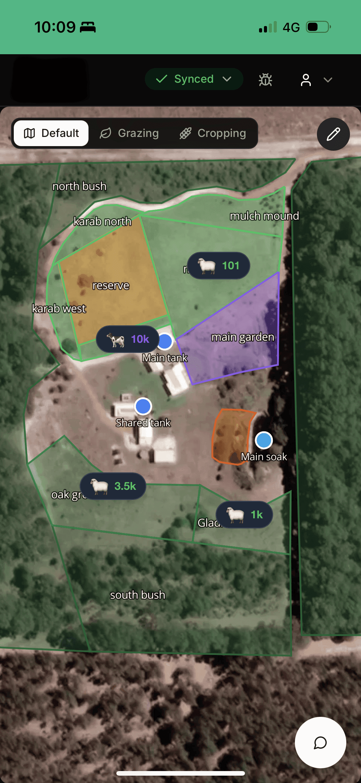
Draw Your Paddocks
Map your property in seconds
Trace paddock boundaries on satellite imagery with your finger. GXL snaps to fencelines and calculates area automatically.
Your whole property, in your pocket
Smartsoil GXL puts high-resolution satellite maps, livestock records, and team coordination into a single mobile-ready platform — designed to work even when you're out of range.
Offline-First
Keep working without reception — everything syncs automatically when you reconnect.
Satellite Maps
View your property from above, draw paddocks, and track livestock locations.
Mobile-Ready
Designed for phones and tablets so you can manage on the go.
Join the alpha
We're actively testing Smartsoil GXL with farmers across Australia. Sign up to get early access and help shape the platform.